Among the deepest lakes in Russia there are reservoirs of various origins, mainly crater and tectonic. The water in them is mostly fresh, since most of the lakes are flowing, and the leaching of salts and minerals is inevitable. There are exceptions, like the Caspian Sea. Although the deepest lakes are located to the south, the main share is grouped in the northern latitudes. The temperature in them is low, such masses of water cannot warm up even in summer.
Modern methods of measuring depth differ from the previous ones. Water bodies of small size, and even located in hard-to-reach places, sometimes remain with outdated metrics for a long time, as was the case with Lake Tabashinskoye. The tourism industry is not developed everywhere. However, Baikal, Ladoga, Teletskoe and some others are ready to offer a wide program to travelers.
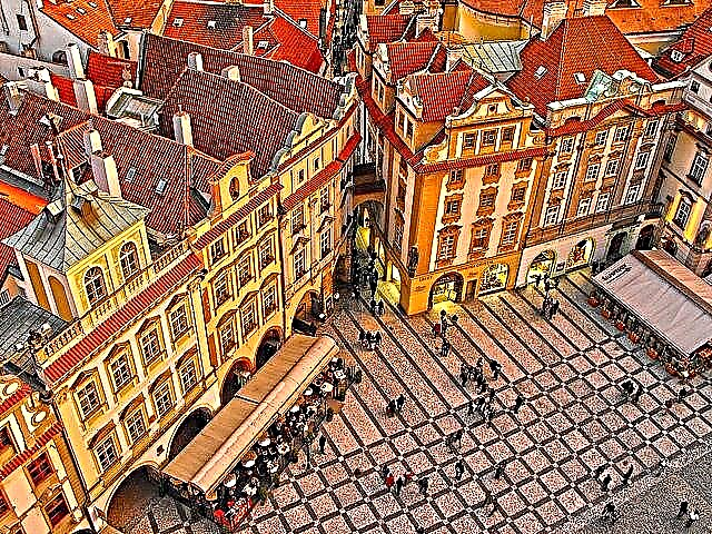
List of deepest lakes in the country
Photos with titles and a short description!
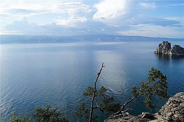
Baikal
Located in Buryatia and Irkutsk region. It is the deepest lake on the planet. The area is over 31.7 thousand km². Transport routes are laid along the ice-covered lake in winter. Many species of unique plants and animals. Attractions - numerous natural monuments: Cape Ryty, Frolikha tract, numerous bays, Chersky peak, Ushkany islands, a lighthouse in the "Baikal harbor" and so on.
Depth - 1642 meters.

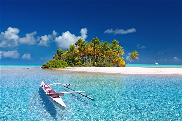
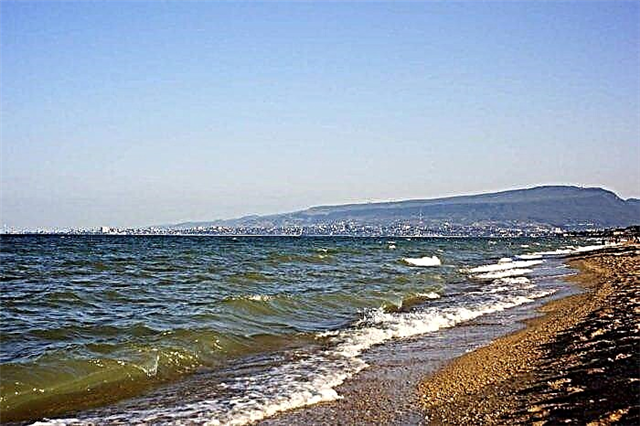
Caspian Sea
Belongs to five countries at the same time, including Russia. It is actually a lake. The area is 371 thousand km². Ports have been built, oil deposits have been explored, and the fishery has been put on stream. It has about 50 large islands. Tourists are attracted by mineral springs, mud therapy, sandy beaches, modern resorts based on the coast. However, the potential of the industry has not yet been realized.
The depth is 1025 meters.
Khantayskoe
It is located in the southern part of the Taimyr Peninsula. The area is 822 km². There is a village of the same name on the peninsula nearby. Fishing is the main occupation of local residents. On the shore you can find old ships covered with rust and then a small plane. The lake is connected with the Small Khantaysky wide channel. The climate is harsh, since part of the territory lies already beyond the Arctic Circle.
The depth is 420 meters.

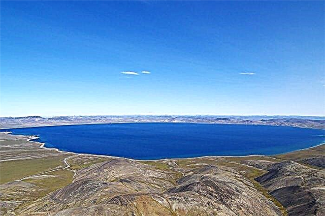
Ring
Lake Onekotan Island, belonging to the Kuril ridge. The area is 26 km². The reservoir was formed after the flooding of the volcano's caldera. The name is derived from the shape of the lake. An island rises above the surface - a modern volcanic structure. Until 2005, it was impossible to get here, Onekotan was closed, only a frontier post worked there.
The depth is 369 meters.
Teletskoe
Belongs to the territory of the Altai Republic. The area is 223 km². Tourist bases and campings have been built, the number of which is constantly growing. Hiking and boating tourist routes have been laid. One of the entertainments is air excursions. Natural attractions nearby: the Yaylu pine tree, the Korbu and Kishte waterfalls, the stone bay, the Chulyshman delta.
The depth is 325 meters.
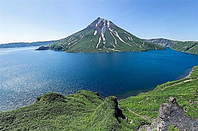
Kuril
It can be found in the south of the Kamchatka Peninsula. The lake was first described in 1740. The area is just over 77 km². There are several islands. The most notable is the Heart of Alaid: pinkish stones, a colony of gulls, an interesting shape. In the Tyoplaya Bay there is an outlet of mineral waters. The area is home to brown bears that come to fish, and the waters are rich in sockeye salmon.
The depth is 316 meters.

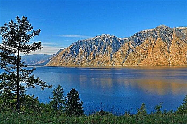
Llama
The lake is located in the Krasnoyarsk Territory. The name translates as "sea" or "big water". The area is 318 km². A popular tourist destination. In the summer months, a river tram runs at the Valyok pier. He delivers visitors to the camp sites of the lake. The water temperature is low, the ice lies for most of the year. There is a memorial sign at the place where the repressed were held in the past.
The depth is 300 meters.

Cerik-Kol
It is part of the Blue Lakes group of Kabardino-Balkaria. The area is slightly more than 2 hectares. The translation of the name is "rotten lake". Hydrogen sulfide deposits begin below the 25-meter mark. The water is so transparent that you can see the bottom for a couple of tens of meters. But its color changes depending on the weather and season. Several tourist centers have been built on the coast.
The depth is 279 meters.

Ladoga
It is jointly used by Karelia and the Leningrad Region. The area is over 17.8 thousand km². There are many attractions on the 500 islands and coastline. The list includes the Oreshek fortress, Valaam, the Road of Life museum. An annual off-road race takes place around the lake. Tourism destinations change with the seasons, each month has something unique to it.
The depth is 230 meters.

Noyon Hol
The location of the reservoir is the Republic of Tyva. The translation of the name is "Prince-Lake" or "Lord-Lake". Area - 52 km². The vegetation and relief of the shores are heterogeneous: larch, cedar tundra, lowlands and hills. There are many small lakes nearby, as well as holy springs. The abundance of fish attracts tourists, and poachers are being fought.
The depth is 225 meters.
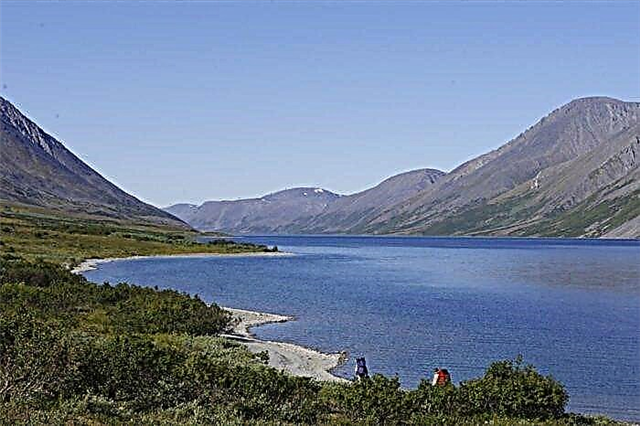
Oron
A lake that can be found in the Irkutsk region. The area is over 51 km². The translation of the name is variable: "deer", "campfire site", "river rapids". It is connected to the Kapyluchikan lake through a channel. Ice covers the surface from October to June. Some species of birds from the Red Book nest near the coast: osprey, peregrine falcon, etc. Belongs to the territory of the Vitim reserve.
The depth is 184 meters.

Many-Hol
Belongs to the territory of Tuva. Area - 30 km². The translation of the name is "marble lake". Near the reservoir there is the Azas reserve and its cordon. Winter fishing is the main reason to come to the lake. Pike bite especially well. The area is considered difficult to access. There is nothing to do here without all-terrain vehicles, shovels, warm clothes and small drills.
The depth is 180 meters.

Chum
Another name for the lake is Khita. Located in the Krasnoyarsk Territory. The area is 452 km². Rafting is arranged along the lake and rivers flowing into it. There is a tourist route along the coast. There are many waterfalls in the area, up to 70 m high. Also, tourists are attracted by numerous caves. There are hunting and fishing camps, including "Northern Oykumena".
The depth is 180 meters.

Elgygytgyn
The lake is located in Chukotka. The area is 119 km². The translation of the name is "White Lake". Ice tightens the surface and in especially cold years does not melt even in summer. Permafrost covers the shores. Drilling of the seabed revealed the impact breccia layer. Received the status of a natural monument of local importance. Svetovidov's long-finned palitia is found, which is found only in Elgygytgyn.
The depth is 174 meters.
Tabashinskoe
Belongs to the territory of the Republic of Mari El. The area is more than 26 hectares. Some consider the information about the maximum depth of 53 m outdated and trust the new measurements, which showed 171 m. A road runs along one of the banks. There is a sandy beach on the south side. Since 1974 it has the status of a natural monument. In the village nearby you can see the Floro-Lavra Church, built at the end of the 19th century.
Depth - 171 meters.

Kronotskoe
Located in the east of Kamchatka. The area is 245 km². There are resident forms of sockeye salmon and several types of char. This is a unique phenomenon that has created an isolated ecosystem. There are islands with a colony of gulls, swans arrive before winter. It is part of a UNESCO World Heritage Site and a Natural Biosphere Reserve. Nearby attractions: Valley of Geysers, volcano, waterfalls.
The depth is 136 meters.

Bolshoe Shchuchye
Located in the Yamalo-Nenets Autonomous District. The area is 12 km². In some places the coast is steep, the southern and northern parts of the reservoir are more suitable for recreation, there are places for tents and cars. The most popular pastime is fishing. Catching some species is prohibited.Despite the name, pikes have never been found here. It has been part of the Gornokhadatinsky biological reserve since 1997.
The depth is 136 meters.
Onega
Belongs to 3 subjects of the Russian Federation: Karelia, Leningrad and Vologda regions. The area is more than 9.7 thousand km². Sightseeing: Kizhi island with a museum-reserve, petroglyphs, museums and architecture of coastal cities. There are many places where tourists can stay, from inexpensive hostels to high-profile hotels, for example, in the Onega Castle. The Onega Sailing Regatta is being held.
The depth is 127 meters.

No one
Lake of the Trans-Baikal Territory. The area is over 40 km². It was first mentioned in 1867. The translation of the name is "fish", which rightly hints at a good bite. The composition of the water is close to rainwater, the concentration of salts is less than in Lake Baikal, although the reservoir is flowing. It does not warm up above + 15 ° С even in the summer months. Around picturesque landscapes and virgin nature.
The depth is 117 meters.

Umbozero
Refers to the Murmansk region. Area - 422 km². It is surrounded on all sides by the Khibiny Mountains - the mountains of the Kola Peninsula. There are islands, one of the largest is Sarvanovsky. The lake is popular with anglers, but some species require a license. It is easy to get there, as there is a road to the reservoir from the north side. Deposits of the unique mineral Umbosirite were found nearby.
The depth is 115 meters.