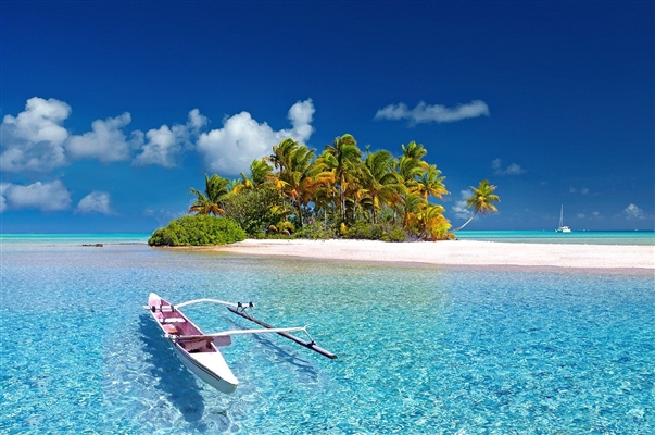
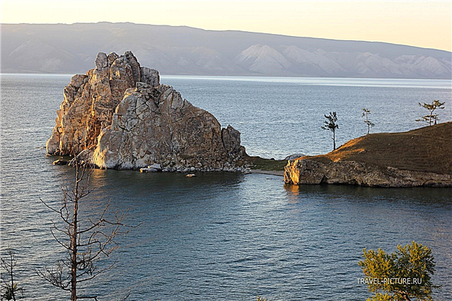
In Africa, lakes do not have a special localization and are found throughout the continent. The only exception is the East African Rift Valley, where the African Great Lakes are located. The arid climate does not prevent water bodies from being the focus of life. Although some of them are highly dependent on the rainy season, the rest of the time they can dry up almost completely. The authorities of a number of countries took care of environmental protection and organized national parks and reserves near the most picturesque lakes.
The species diversity is also protected, thus the population is being restored. There are lakes, both salty and fresh. In the first case, industrial salt production is not uncommon, in the second - the use of water for agriculture. In terms of tourism, reservoirs are also attractive. Where there is no infrastructure and large hotels, travelers are lured on a safari or look at authentic Africa.
The most famous lakes in Africa
Victoria
It is the largest lake in Africa by area. Belongs to the territory of Uganda, Kenya and Tanzania. The area is 69 thousand km², the maximum depth is about 84 meters. Platinum was built in 1954, making Victoria a reservoir. The average annual air temperature in the district is above + 20 ° C, two rainy seasons per calendar year. Tours to the lake can be ordered in any major city in the region. Even local fishermen conduct excursions.

Tanganyika
The deepest lake in Africa. Belongs to 4 countries: Tanzania, DR Congo, Burundi, Zambia. The area is almost 33 thousand km², the maximum depth is 1470 meters. The sizes change throughout the year, due to the hot climate and the drying up of the rivers flowing into Tanganyika. Fishing is carried out almost throughout the territory. There are large port cities. There are hotels in picturesque bays. Relying on poor tourists and exotic lovers.

Nyasa (Malawi)
Located in Malawi, Mozambique and Tanzania. The area is more than 29.5 thousand km², the maximum depth is 706 meters. There are sandy beaches, diving and spear fishing opportunities. The coastal zone is not too populated, the infrastructure is outdated in some places, or not developed. Fishing is not typical for all parts of the lake. Tourists are attracted by picturesque views, rare plants and animals. The ecology is getting worse every year.

Rudolph (Turkana)
Located in Kenya and Ethiopia. The area is 8.5 thousand km², the maximum depth is 73 meters. Opened in 1888 and named after the Crown Prince of Austria. The local name Turkana was assigned to the lake already in the 70s of the last century. There are three islands of volcanic origin. There are a lot of crocodiles in the district, including abnormally large individuals. The area is also famous for archaeological finds from different periods.

Edward
Shared by DR Congo and Uganda. The area is over 2.3 thousand km², the average depth is 17 meters. Named after the British King Edward VII. Belongs to the system of the Great Lakes of Africa. A canal links it to nearby Lake George. There are several national parks in the area, whose activities are aimed at preserving elephants, chimpanzees and other representatives of the fauna. Included in the route of migratory birds.

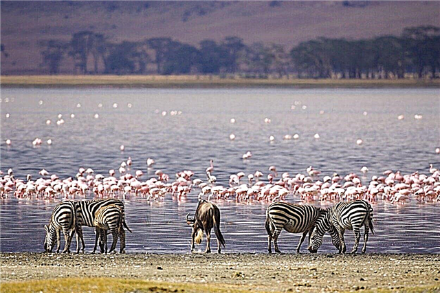
Natron
It can be found in northern Tanzania. The area is 1 thousand km², the average depth is one and a half meters. The presence of salt and microorganisms triggers processes in the water, due to which the lake periodically turns pink. Hundreds of thousands of flamingos can be found here at the same time. The pool is protected by the Ramsar Convention. This agreement allows the conservation of both wetlands and waterfowl.

Retba
Located in Senegal near the Cape Verde Peninsula. Area - 3 km², maximum depth - 3 meters. Due to the large number of halophilic archaea, the color of the water is pink or close to it. The salt content in the water is close to 40%. Continuous mining began in the 70s of the last century. Being in water without special means for 10 minutes or more threatens to get burns.

Chad
Belongs to Chad, Nigeria, Niger and Cameroon. The name translates as "big water". The area is more than 1.3 thousand km², the average depth is one and a half meters. Sizes vary depending on the season. The lake has explored deposits of soda, which is actively extracted, and oil. Work is underway to prevent the drying out of the reservoir. In the coming years, it is planned to build canals and bring outflow from the Congo basin to Chad.

Albert
Located on the border of DR Congo and Uganda. The area is 5.6 thousand km², the average depth is 25 meters. Opened in 1864 and named after Queen Victoria's husband. The banks are steep for the most part. There are villages and ports, shipping between them is well developed. The area around is varied, with wetlands, mountains, beaches and tall thickets. The fishery is on stream, there are more than 40 species of fish in the lake.

Kivu
Located in the border area of DR Congo and Rwanda. The area is 2.7 thousand km², the maximum depth is 480 meters. The Ruzizi River connects it with Lake Tanganyika. There is a legend about the eruption of a nearby volcano, when the water in Kivu boiled and the fish boiled. There are methane deposits at the bottom, which carries the threat of an explosion in the event of an earthquake and other cataclysms.

Assal
Crater salt lake in Djibouti. The area is 54 km², the average depth is more than 7 meters. The location of the lake is the lowest point on the continent. The salt content is comparable to that of the Dead Sea. Salt production is carried out on an ongoing basis and is important for the country's economy. The banks look rocky due to the salinity of the soil. A natural attraction nearby is the Gubbet Kharab Bay of the Tajura Bay.

Manyara
Located in the north of Tanzania. Dimensions - 50 by 16 km. It is known for its proven deposits of salts and phosphate. The coastline is characterized by uneven vegetation. There are several hot springs nearby. It is included in a number of permanent tourist routes. Lovers of watching animals will be especially interesting here. There are buffaloes, lions, rhinos in the area.

Tana
Located in the northwest of Ethiopia. The area is 3.5 thousand km², the maximum depth is 15 meters. About 50 rivers flow into it, and only the Blue Nile flows out. The local population is engaged in fishing and uses water from Tana for agriculture. The main attractions of the lake are the islands. Christian monasteries and temples were built on them, as well as many rulers of the country were buried.

Bangweulu
The water system of Zambia, which includes not only a lake, but also a swamp with a floodplain. The area is more than 15 thousand km², the maximum depth is 5 meters, it is fed by almost 20 rivers. Plays an important role in the economy of the region. There are many fishing villages on the coast. Although the tourist infrastructure is poorly developed, the influx of travelers is significant. They come for African authenticity.

Mweru
Belongs to DR Congo and Zambia. The area is more than 5 thousand km², the maximum depth is 27 meters. Unlike most lakes, Mweru is not particularly affected by the rainy season. The coast is built up with fishing villages. Populations of birds and animals are still recovering from the poaching that raged here in the past. A modern road was built to the reservoir, which made life easier for locals and tourists.
Kyoga
A complex of lakes in Uganda, with a total area of over 1.7 thousand km². The maximum depth is up to 6 meters. Floating islands formed from papyrus drift between small islands. Around wetlands, partially overgrown banks, a lot of fish. Together, this created excellent conditions for the reproduction and life of crocodiles. The outflow of water from Kyoga to the White Nile is hindered by natural congestion.

Nakuru
Located in central Kenya. The translation of the name is "dusty place". The area is up to 40 km², the maximum depth is up to 3 meters. The water is salty, a lot of algae and phytoplankton. There is a persistent and impressive population of flamingos. It is part of the national park of the same name. It has expanded since its founding and now includes part of the savannah. People come here to watch rhinos.

Kariba
A reservoir formed in 1959 on the Zambezi River. Belongs to the territory of Zambia and Zimbabwe. The area is 5.4 thousand km², the maximum depth is 78 meters. Downstream are the national park and biosphere reserve. As the surrounding area ceased to be flooded during the rainy season due to the dam, the fauna also changed. For example, acacia and floating fern have grown extensively.

Bogoria
Alkaline salt lake in Kenya. Area - 33 km², average depth - 5 meters. Very high alkali content. Salinity in dry seasons reaches 100 ‰. You can easily find active geysers on the shores. The height of their fountains reaches 5 meters. Protected primarily because of the flamingo population - 2 million individuals. It is part of the reserve of the same name. UNESCO World Heritage Site since 2011.

Bunyoni
Spreads out in the southwest of Uganda. Dimensions - 25 by 7 km. The translation of the name is “place of small birds”. There are 29 islands, each home to exotic birds - about 200 species. It is safe to swim here as there are no crocodiles and tropical diseases. Local residents arrange excursions and canoe trips for tourists for a small fee. From a height, the outlines of the lake resemble a walking giraffe.

Nasser
Reservoir formed on the Nile River. Geographically it belongs to Egypt and Sudan. Named after the President of Egypt. The area is more than 5 thousand km², the maximum depth is 130 meters. It appeared in the 60s of the last century. Specialists from the USSR took part in the construction of the dam. During construction, many national ancient monuments, including the Temple of Isis, were removed from the flood zone.

Naivasha
Kenyan freshwater lake. The translation of the name is "stormy water". From time to time strong winds rise here, making the lake restless. This is due, inter alia, to its location - the highest part of the Great Rift Valley. The area is 139 km², the average depth is 6 meters. The lake is notable for a large variety of birds - about 400 species, as well as a colony of hippos.

Volta
In fact, it is a reservoir on the river of the same name. Located in Ghana. It appeared in the 60s of the last century after the construction of a hydroelectric power station. The area is 8.5 thousand km², the maximum depth is 80 meters. Fishing is on stream. Navigation is well developed, including tourism. The shores are densely populated. The terrain is heterogeneous, in the north - savannas, in the south - tropical forests.

Nyos
Located in the northwest of Cameroon. The area is almost 1.5 km², the maximum depth is 210 meters. It has a crater origin, surrounded by mountains. On the north side, it is bounded by a natural dam crossed by a channel. Water degassing is carried out periodically to prevent the 1986 disaster, which killed more than 1,700 people. The banks are strengthening, the water level is dropping.

Mai Ndombe
Freshwater lake in the southwest of DR Congo. In the past, it bore the name of the King of Belgium, renamed after the country gained independence. The area during the rainy season is up to 8.2 thousand km², the rest of the time - 2.3 thousand km². The maximum depth is 7 meters. Formed from a huge closed lake that existed here a million years ago. New species of flora and fauna are being discovered in the district every now and then.

Rokva
Located in the southwest of Tanzania. The area is 2.6 thousand km², the average depth is 3 meters. In dry periods, it dries up almost completely. This salt lake has several tributaries. During the rainy season, which lasts from October to April, additional temporary rivers appear. There are many waterfowl, especially pelicans, about 60 species of fish. It is part of the Katavi National Park.

Tengrela
Located in the southwest of Burkina Faso. Dimensions - 2 x 1.5 km. There are small settlements on the coast. Fishing is a popular craft for the locals. Rich in aquatic vegetation, especially water lilies. Tourists come here to watch hippos, their colony lives here all year round. It is part of some safaris, although it is not the main attraction.

Abbe
This salt lake is the border between Ethiopia and Djibouti. The area is 320 km², the average depth is over 8.5 meters. The lake has limestone peaks, also called pillars. Vapor eruptions sometimes occur over the surface. Their height reaches 50 meters. Food is mixed, including fresh water from the Avash River and thermal springs rich in salts and minerals.

Magadi
Salty closed lake in Kenya. Area - 104 km², maximum depth - 1 meter. The area is rich in salt springs flowing from faults. The reservoir has become smaller over the years. In the areas left without water, layers of rock salt lie. And at the bottom, the so-called "Egyptian salt" is formed, which has been mined here for 80 years. In Magadi there is only one kind of fish, but many kinds of birds.

Chala
Crater lake on the border of Tanzania and Kenya. Area - 4.2 km², maximum depth - 98 meters. Tourists are offered kayaking and swimming, although crocodiles have been spotted here at some times. You can get to the reservoir by off-road vehicles through the rainforest. There are meetings with Bedouins. The rainy season is short. Nearby attraction: Mount Kilimanjaro.