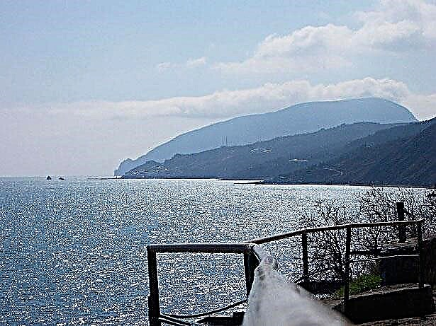
The Stavropol Territory is famous not only for its mineral springs, but also for rivers and lakes. The region is located in the Ciscaucasian zone, in the valleys of the Kuma, Kalaus, Yegorlyk rivers. The names of the rivers come from the Turkic language. The relief is complex. The rivers of the region flow into the Caspian or Azov seas and are subdivided according to the basins of these two seas.
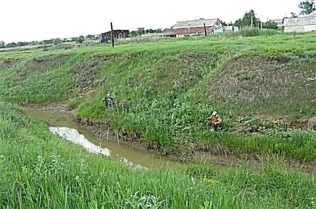
There are about two hundred and twenty rivers and rivulets in the Stavropol Territory. The length of most rivers is from 100 to 200 km. In the eastern part, the edges of the rivers are highly mineralized, which is explained by the salinity of the soil. Rivers exist due to melting snow and precipitation. It is necessary to pay attention to the ecology of small rivers. These rivers need to be cleaned up.
The longest rivers of the Stavropol region
List of the region's largest rivers by length!
Kuma
The source of the Kuma River is located on the rocky ridges of the Karachay-Cherkess Republic. It is a wayward, muddy, mountain river with a turbulent current, many whirlpools. Kuma carries its waters in clay banks up to 50 m high. Hydrogen sulfide mineral springs are found in the river valley. The river is fed by groundwater and precipitation. Catfish and other fish are found in the river. Not every year Kuma reaches the Caspian Sea. In a dry year, it dries up earlier. The river is used for irrigation of the Kuma valley.
The length of the river is 802 km, in the Stavropol Territory - 584 km

Egorlyk
The source of the river is on Mount Strizhament. Here, many springs are connected to streams that form a river. The river water is initially muddy and bitter-salty. The right side of the river is higher. The high water content of the Yegorlyk River increased significantly after the construction of the Nevinnomyssk Canal in the middle of the 20th century. Currently Yegorlyk is part of the Kuban-Yegorlyk irrigation system.
The length of the river is 448 km, in the Stavropol Territory - 284 km

Kalaus
It originates from the Bryk mountain. There are Maikop clays nearby. For this reason, the water is cloudy, salty, and unsuitable for drinking. The river is fed by melting snow, springs and rain. The banks of Kalaus are steep, steep, reaching a height of 15 m. Kalaus - flows into the Western Manych on the left and belongs to the basin of the Azov Sea.
River length - 436 km

Manych
The river originates in Kalmykia at the confluence of the Kalaus and Eastern Manych rivers. It flows into the Don River near the village of Manychskaya. Manych water has a high degree of mineralization. Emergent vegetation cannot develop in such water. The salinity of the water decreased after the supply of water from the Kuban River in 1948. The river is fed mainly by snow melting. The river is used for irrigation of fields. Navigation and fishing are well developed.
The length of the river is 420 km, in the Stavropol Territory - 115 km

Kura
The Kura branches off from the Malka River. The river is shallow. Near the Kura River, there is the Glubokoe tract, a favorite resting place for the local population. Biologists have explored the area for four field seasons. Found ten species of endangered plants. In a small area, the Kura is the border between the Stavropol Territory and Kabardino-Balkaria. The mouth of the river is lost in the sands of the Nogai steppe.
River length - 198 km

Bitter beam
It originates from a small spring in the Georgievsky district. The banks of the river are heavily overgrown with reeds and reeds. It is home to wolves, wild boars, foxes and muskrats. It flows into Lake Beloe. In the 50s of the XX century, the river almost left completely due to the unsuccessful construction of the Nogai waterway. The water from the semi-stagnant river began to subside with great speed. All the fish died. To save the river, a retaining dam was urgently erected.
River length - 183 km

Podkumok
It is the largest tributary of the Kuma. It flows into the Kuma River on the right side downstream in the village of Krasnokumskoye. The source is near the Gum-Bashi mountain in Karachay-Cherkessia. The river is turbulent as it crosses the Pyatigorsk region. In the upper reaches, the Podkumok flows through a rocky canyon up to 400 meters deep. In 1903, the first in Russia hydroelectric power station "White Coal" began to operate near the city of Essentuki.
The length of the river is 160 km, in the Stavropol Territory - 115 km

Big Zelenchuk
The left tributary of the Kuban, the green pearl of the North Caucasus. The source is located on Mount Pshish (height over 3 km). The river has six known rapids. Kayakers and water tourists float along the river. At the source it runs between the Arkhyz mountains and along the Arkhyz reserve. The forest along the banks of the river is coniferous. And below, after the Bogoslovka tract, deciduous forests predominate. The settlement of lower Arkhyz is an astrophysical center. The diameter of the RATAN telescope is 600 meters. Kurlyuk Canyon, a natural monument, stretches for 1.5 km. Tundra vegetation is located right on the rocks. There are no industrial enterprises on the river.
The total length of the river is 158 km

Wet buffalo
It flows into Kuma on the left side. The source of the river at the Prikapausky heights. From the source, the river is called Buffalo. After the confluence with the Dry Buffalo, the river is already called the Wet Buffalo. The river has 53 tributaries. But the river runs only when the snow is melting and during heavy rainfall. In the 19th and 20th centuries, there were many mills on the river, and cattle were raised. Currently, there are several reservoirs on Mokra Buffalo. The water of the river is used for irrigation of fields.
River length - 151 km

Wet Karamyk
The estuary is located on the left side of the Kuma River in the city of Zelenokumsk. The source of the Wet Karamyk is located on the southern side of the Prikapausky heights. In the upper reaches, the Mokry Karamyk has several channels. In the Georgievsky district, the Wet Karamyk flows in one channel. The water in the river is muddy and mineralized. The banks are overgrown with Reeds. In the hot season, the river dries up.
River length - 142 km

Aygurka
In Turkic it means "Stallion". The river flows into Kalaus on the right. The source of the river near the village of small Yagury. In the hot months, Aygurka dries up. Additional water supply to the river is carried out from the Big Stavropol Canal. There are ten ponds and a large reservoir on the river. The water in the upper reaches is fresh, and after the confluence of the Kazlak river it becomes salty. In the fresh water of the river, crayfish and fish are found: carp, hamsa.
River length - 137 km

Tomuzlovka
The source of Tomuzlovka is considered to be a clean spring in the forest near the village of Aleksandrovskoye. The river is fed not only by springs, but also by rains and melting snow. The river passes the Volch'i Vorota reservoir. The Tomuzlovka River flows into the network of the left-bank Kumsky Canals on the outskirts of the city of Budyonnovsk.
River length - 122 km

Surkul
The river is typical steppe. Intense current in it only in spring, when the snow melts. Food comes from the large Stavropol Canal, from melting snow and precipitation. The estuary is located on the left bank of the Kuma River in the Mineralovodsky District. There were ancient caves along the banks of the Surkul River, but they were blown up. The river is rich in fish.
River length - 119 km
Raguli (Kucherla beam)
Food near the river is mixed: from tributaries and springs, from rains. Raguli flows into the Chograiskoye reservoir, previously the mouth was located 109 km of the Vostochny Manych river along its right bank. At the confluence of the Raguli and Kucherla rivers, there is the village of Kucherla. In 1972 and 1982, meteorites were found in the vicinity of the village.
River length - 117 km

Big Kugulta
Mouth on the right bank of the Yegorlyk River. The largest tributaries of the Big Kugulta are Berestovka and Shangala. The Bolshaya Kugulta River flows through the steppe. Villages, settlements and farms are located along its banks. There are dams built in several places. All rivers of the Stavropol Territory are rich in fish. And big Kugulta is also of interest to fishermen.
River length - 112 km