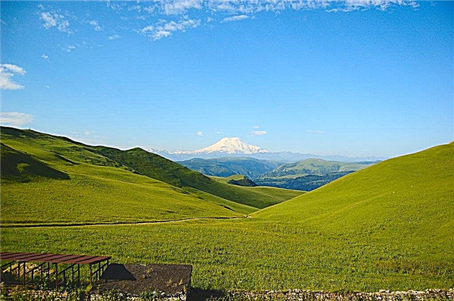
The Krasnoyarsk Territory is rich in various natural resources: coal, ore, marble, graphite, forests and water resources. Water is a special resource. It does not disappear without a trace. She is in constant circulation in nature. Life is impossible without water. About two hundred and fifty thousand rivers and rivulets flow through the territory of the region.
The total length of all rivers is about 2 million km. The rivers of the region at the very end of the path flow into the Arctic Ocean. Local runoff makes up almost one fifth of the runoff of the entire country. Most of the rivers in the region are navigable. A natural river transport system was formed. Cheap hydropower is also a wealth of the Krasnoyarsk Territory.
The longest rivers of the Krasnoyarsk Territory
List, photo with names and descriptions of the main rivers of the region.
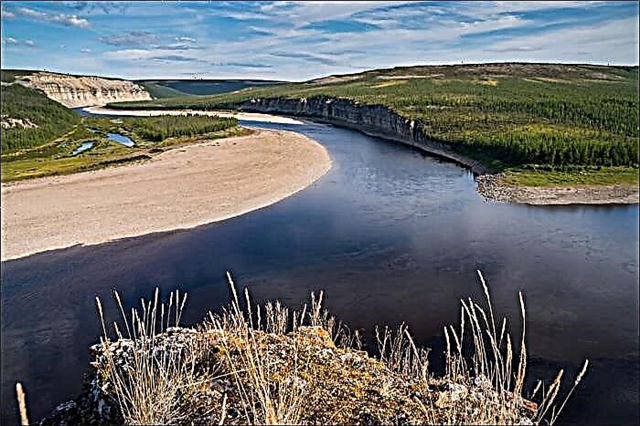
Yenisei
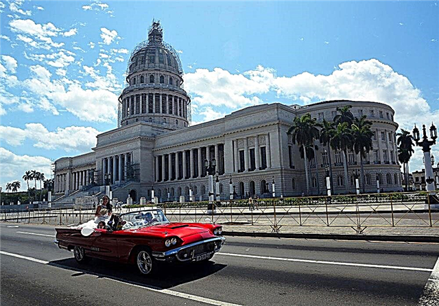
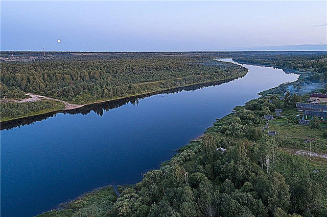
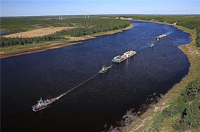
The river basin occupies more than half of the region's territory. The main city on the river is Krasnoyarsk. The Yenisei has 2.5 times more water than the great Russian Volga River, 3 times more than the Danube and 6 times more than the Dnieper. The source is two rivers: the Big and Small Yenisei, which merge near the city of Kyzyl. The tributaries of the Yenisei are about half a million. The river will divide Eastern and Western Siberia into two halves. The river is navigable.
The length of the river is 3487 km, in the Krasnoyarsk Territory - 1944 km.

Don't miss: 45 main attractions of Krasnoyarsk.
Lower Tunguska
The river flows in two regions: the Irkutsk Region and the Krasnoyarsk Territory. The river is passable for ships to the village. Tour in the flood. It flows into the Yenisei on the right. From October to May, like most rivers in the region, the Lower Tunguska is under the ice. There are rapids in the lower reaches of the river. On the banks there are kurums. Navigation in these places is difficult due to the large number of rapids.
The length of the river is 2989 km, in the Krasnoyarsk Territory - 1350 km.

Podkamennaya Tunguska
The source of the river is on the Angarsk ridge. In addition to the Krasnoyarsk Territory, it also flows in the Irkutsk Region. It flows into the Yenisei on the right. Basically, Podkamennaya Tunguska is a mountain river with rapids. The river became famous after the fall of the Tunguska meteorite in 1908. But the place of the fall is located 60 km from the river bank. There are many weathered rock outcrops along the banks - “pillars”. Fish are abundant in the river. In the lower reaches of the river, ships sail for 1146 km.
The length of the river is 1865 km, in the Krasnoyarsk Territory - 1573 km.
Chulym
It flows into the Ob along the right bank. Chulym rolls its waters across the Krasnoyarsk Territory, four neighboring regions and the Republic of Khakassia. The rivers Bely Iyus and Black Ius, merging, form Chulym in the area of Solyonoozerskaya stanitsa. To the city of Achinsk, Chulym is a mountain river. In the lower reaches, the Chulym flows along a wide floodplain, forming many lakes and old channels. The width of the river in this place is more than 1 km. In some areas, the river is heavily polluted.
The length of the river is 1799 km, in the Krasnoyarsk Territory - 1045 km.
Angara
The largest tributary of the Yenisei is on the right side. At the mouth of the Angara River, it is twice as wide as the Yenisei. The source of the Angara is a huge lake - Baikal. The Angara carries its waters from the Irkutsk Region to the Krasnoyarsk Territory. The water in the river is very clean. You can see every stone at the bottom. Angara is a source of hydropower: since the 60s of the XX century, a cascade of hydroelectric power plants was built on it. In the middle course on the banks of the Angara, manganese, apatite, and gold are mined.
The length of the river is 1,779 km, in the Krasnoyarsk Territory - 680 km.
Ket
The source is located in the south of the Yenisei region. The river flows on flat terrain. Mixed taiga grows along the sandy-clay banks of the river. There is a lot of silt at the bottom of the river. The water in the river is clean. Due to the muddy bottom, the water has a brownish tint. There are twenty species of fish in Keti, the most valuable of which are sterlet, sturgeon and nelma. There are no industrial enterprises on the Keti River. It flows into the Ob along the right side with two sleeves. This is already the Tomsk region.
The length of the river is 1621 km, in the Krasnoyarsk Territory - 831 km.

Kotui
The source is located in Evenkia on the Putorana plateau. Kotuy merges with the Kheta River near the village. Crosses and the Khatanga River is formed. The water in the river is clean. Kotui is a stormy river that runs among the basalt mountains. There are almost impassable rapids on the river that attract water tourists. Like many Siberian rivers, Kotui is rich in valuable large fish: whitefish, wild boar, grayling, taimen, pike. On the banks of the river there are many winter quarters - hunting trailers. They are moved on skids across the ice.
The length of the river is 1409 km.
Kureika
Known as Luma (Numa). It flows into the Yenisei along the right bank. Kureyka along its entire length is a polar harsh mountain river. There is little vegetation along the banks: only moss and lichens. Only 160 km from the mouth, the river expands to 500 meters. The river is getting slower. The navigable section is only 100 km above the mouth. The Kureiskie graphite mines are located 120 km from the mouth. In these places at the beginning of the XX century. exiled political prisoners, among them was I. V. Stalin.
The length of the river is 888 km.

Moyero
The Moyero flows into the Kotui on the right bank. Moyero originates from Lake Holu in the Anoan Mountains. It flows through the taiga territory called Evenkia. The depth of the river is from up to 1.5 meters. In the upper reaches and in the middle part, the course of the river is rather fast, there are rapids made of basalt. The shores are rocky canyons. In the lower reaches, the river becomes wide. Fishermen going to the river need to be prepared for harsh climatic conditions, infestation, and lack of mobile communications.
The length of the river is 825 km.

Pyasina
It originates from the lake of the same name. Estuary - Kara Sea (Pyasinsky Bay). Freezing up - from October to June. Pyasina is mentioned in historical documents of the 17th century. Coal deposits are found along the banks. For small vessels, the river is passable for 700 km from the mouth to the village. Crosses. Navigation lasts two months a year. In the river are found: muksun, whitefish, omul.
The length of the river is 818 km.

Kochechum
The river begins in the north of Evenkia. It flows in two branches into the Lower Tunguska along the right bank near the village. Tura - the administrative center of Evenkia. The village even has an airport. There are no other settlements on the river. In the upper reaches, the river is very fast with cold clear water. Downstream, the channel gradually becomes wider, reaching 400 meters. The banks of the river change depending on the terrain.
The length of the river is 733 km.

Chunya
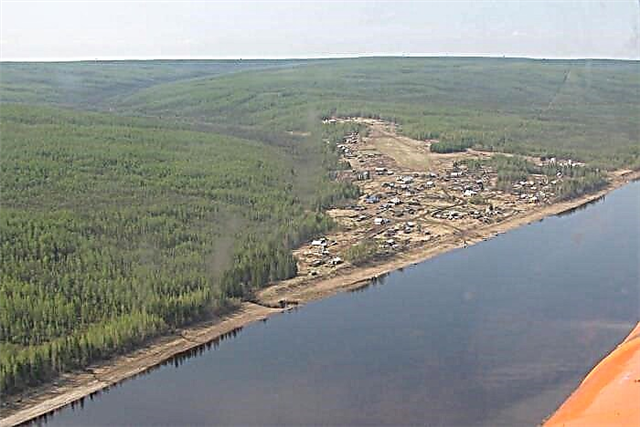
Formed by the confluence of two rivers: South and North Chuni. The Chunya flows into the Podkamennaya Tunguska from the right bank. The river flows through Evenkia. There are rapids on the river. The banks of the river are swampy. There are bears. On the left bank of the river in 1925, the village of Strelka-Chunya was built. It is home to about two hundred inhabitants. The village has everything you need for life: a medical office, a kindergarten, a school, shops, a post office and an airfield.
The length of the river is 727 km.
Shim
It originates somewhere in the swamps of the West Siberian Plain south of the Taz River. It flows into the Yenisei on the left along the stream. The river washes away high banks. Forests grow along the banks of the river. The area along the banks of the river is sparsely populated. The Sym River is navigable above 265 km from the mouth. On Sima there is a felling and rafting of timber. Transfer to the Sym River only by helicopter to the village of Yartsevo, then you can reach Sima by motor boat.
The length of the river is 694 km.
Dutypta
The source of the river from Lake Makara. Dutypta flows through the Taimyr tundra, through swamps. It flows into Pyasina on the right. 150 km from the mouth of the Dutypta it becomes a navigable river. The river basin is located on permafrost. The frozen ground goes up to 5.5 meters deep. Dutypta belongs to the lowland rivers. The width of the river bed reaches 150 meters. Valuable fish species are also found. There are no settlements on the river.
The length of the river is 687 km.

Maymecha
The source of the river is in Lake Arylakh on the Putorana Plateau. It flows into Hetu. There are no settlements on the river, there are camps of geologists and hunting huts. Maimecha flows through a narrow valley among steep slopes. There is a kimberlite pipe in the Maymecha-Kotuy region, diamonds are mined.The river is of interest for extreme boating and fishing.
The length of the river is 650 km.

Chadobets
The source is located on the Tunguska ridge. The estuary is on the Angara River on the right side. Chadobets flows through forests and swamps. This is one of the wildest rivers in the region, rich in fishing grounds. In the lower reaches of the river, ships sail. There are three serious rapids not far from the mouth. There is only one settlement on the river - the village of Yarkino. There is a natural monument on the river "Yurokhtinskoe mnogoostrovye", where rare birds nest.
The length of the river is 647 km.

Big Kheta
Starts in Lake Spruce. The estuary is in the Yenisei River on the left. The river flows in the north of the Dolgano-Nenets Autonomous Okrug. In the upper reaches of forty kilometers, it is a mountain river rushing among steep slopes covered with dwarf trees, lichens, and moss. Then the river goes out to the plain. In the upper reaches, the river freezes over in winter. Increased turbidity in the river is observed in the summer. The water contains a high content of sulfates. The quality of the water is clean.
The length of the river is 646 km.

Turukhan
The mouth is in the channel of the Yenisei Bolshoi Shar. In the lower reaches, 270 km from the mouth, the river is navigable. In dry years, Turukhan grows shallow and becomes impassable for ships. From settlements on the river: Yanov Stan, Farkovo. The village of Staroturukhansk and the village of Turukhansk are located in the area of the mouth. The area along the banks of the river is the tundra. The banks of the river are peaty and low.
The length of the river is 639 km.

Kahn
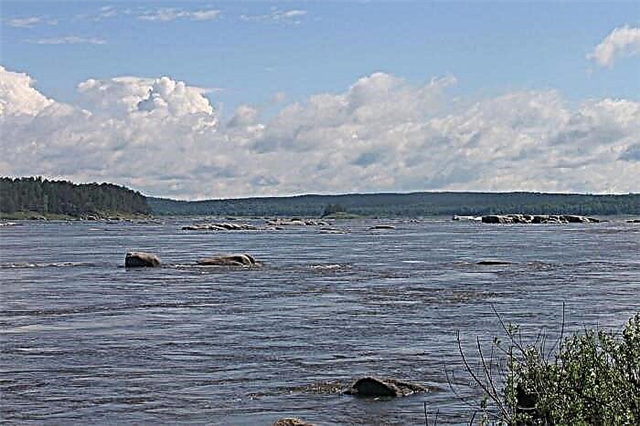
The river flows down from the eastern slopes of the Kanskoe Belogorye (Eastern Sayan) mountains. It flows into the Yenisei on the right downstream. Caen is a mountain river with numerous rapids. In the middle reaches, the Kan becomes a flat river. The river is partly navigable. From Komarov the river runs along the gorge, there are rapids: Komarovsky, Kemerovsky, Kosoy, Bolshoi. Then Kahn flows calmly across the plain again. The first settlements on the river appeared in the 17th century. Archaeologists find artifacts from the Neolithic-paleometal times along the banks of the river.
The length of the river is 629 km.

Ilimpea
The source is in the Central Siberian Plateau. Estuary - Lower Tunguska along the left bank. Because of the rapids, the river is not navigable. The river runs through the Taiga area through the permafrost in the Evenk Autonomous Okrug. The lower reaches of the Ilimpei are rapids. Freezes in October-November, opens in May. It is believed that the Tunguska meteorite was found in the river basin at the beginning of the 20th century. There are no settlements on the river. Commercial fish includes finch breeds.
The length of the river is 611 km.

Lower Baiha
It flows into Turukhan. It flows through the eastern part of Western Siberia, through the typical northern taiga. The river flow is slow, there are no rapids or rapids. Freezing up on the river from October to May. Two summer months of the year, motor boats run along Nizhnaya Baiha. On the banks of the river such rare birds as the taiga bean goose and the whooper swan nest. The banks of the river are not inhabited by people.
The length of the river is 608 km.

Heta
The river is frozen in ice from September to May. The source is on the Putorana Plateau, where the Ayakli and Ayan rivers join. Not far from the village. The Kheta Crosses merges with the Kotui River. The bottom of Kheta consists of hard rocks. The river bed even on the plateau reaches 150 m, and downstream, on the plain, the river becomes even wider. The river is inhabited by valuable species of commercial fish: muksun, vendace and others.
The length of the river is 604 km.
Tembenci
The source of the river between the Promislovy and Oyogonda ridges on the Putorana Plateau. It flows through the sparsely populated mountain regions of the Krasnoyarsk Territory with a very harsh climate. There is not a lot of vegetation along the banks: only grasses, mosses and lichens. It flows into Kochechum along the right bank. The river flows through the lake of the same name. Many herbs and flowers grow along the shores of the lake in summer.
The length of the river is 571 km.

Popigay
The source of the river is Lake Chonno-Kyyole. The mouth is the Khatanga River. There are rapids on the river. In the lower reaches, the river valley is swampy. Every year in August it starts to rain on the river. The river becomes deep and brown. At this time, a motor boat can easily navigate along the Popigai River. Many wild geese nest in the river valley, and red-breasted geese are found. There are villages: Sopochny - inhabited by residents, and Popigay - an abandoned village.
The length of the river is 532 km.

Mana
The source of the Mana River in Lake Verkhmanskoye (Eastern Sayan Mountains). The river has an underground section about 1 km long. At the exit there are many cold springs with hydrocarbonate drinking water. In the upper reaches the river is rapids. In the lower reaches, the river is passable for ships. At the beginning of the 20th and 21st centuries, gold was mined on the river at the Yulievsky mine. Until 1986, molten timber rafting took place along the river. Krasnoyarsk residents like to rest on the Mana River.
The length of the river is 475 km.