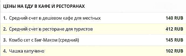
The most important waterways of the region are Medveditsa (745 km) and the Don section, 537 km long, which flows through the Volgograd region. The largest river in Europe, the Volga, crosses the region almost along its border, and the length of this section is relatively short - only 318 km. Water basins belong to the Caspian and Azov Seas. The nature on the banks of the rivers is typical for the forest-steppe and steppe zones.
Many rivers of the Volgograd region flow through the territory of protected natural zones. Such natural monuments as Tsimlyansk Sands, Donskoy Natural Park, Koziy Yar, Green Ring are known. On the lower reaches of the Khara River there is a unique salt lake Elton, and a natural monument - Eltonsky Park. Fishing is developed on all rivers.
The largest rivers of the Volgograd region
List of the longest rivers flowing in the region.
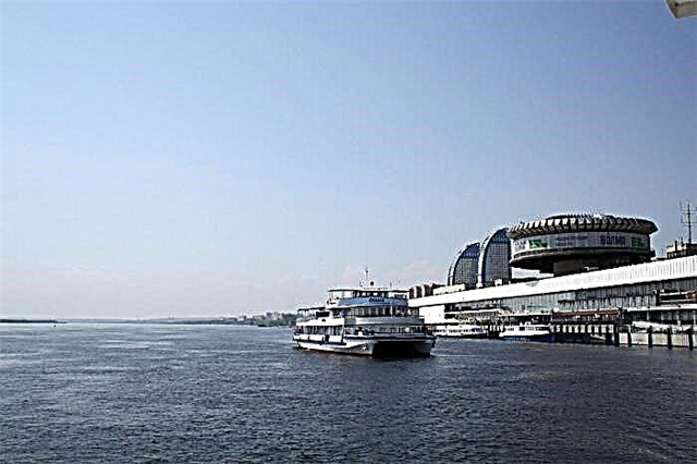
Volga
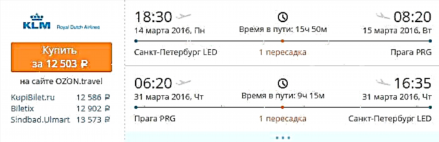
One of the largest rivers in the world and the largest in Europe. The lower reaches of the Volga are located on the territory of the Volgograd region. The total area of the river basin within the region is 15.4 thousand m2... Above Volgograd, the left branch, Akhtuba, is separated from the Volga, which flows parallel to the main channel. The left tributary located in the Volgograd region is the Eruslan River.
The length of the river is 3530 km, in the Volgograd region - 318 km.
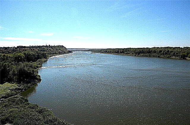
Don
The fifth longest river in Europe. Two large tributaries in the region are the Khoper and Medveditsa rivers. In the area of the city of Kalach-na-Donu, the current narrows, the floodplain of the river is practically absent. The banks of the Don in the Volgograd region are famous for their picturesque landscapes, especially in the Kalachevsky, Serafimovichsky and Frolovsky districts.
The length of the river is 1870 km, in the Volgograd region - 537 km.

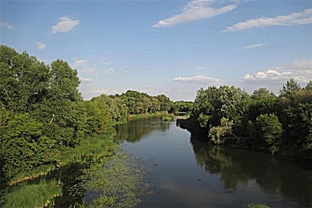
Khoper
The largest left tributary of the Don. It flows on the territory of five regions, from the source in the Penza region to the mouth in the Serafimovichsky district of the Volgograd region. The river is considered one of the most geologically ancient rivers in the south of Russia, and at present it is one of the cleanest bodies of water in Europe. Fishing and hiking are well developed on the river.
The length of the river is 979 km, in the Volgograd region - 325 km.

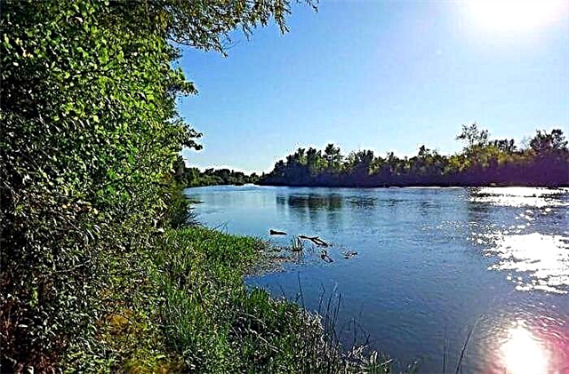
She-bear
The river originates in the Saratov region, at the confluence of two streams in the village of Starye Burasy. On the territory of the Volgograd region, it flows through two large settlements - Zhirnovsk and Mikhailovka. A small hydroelectric power station was built on the river near the village of Fomenkovo. The name of the river is associated with the legend about its appearance from the tears that the bear shed over the cubs killed by the hunter. One of the cliffs of the Medveditsa coast was named "Koziy Yar" and has the status of a natural monument.
The length of the river is 745 km, in the Volgograd region - 416 km.
Akhtuba
This is the left arm of the Volga, which is separated from it just north of Volgograd. It flows on the territory of the Volgograd and Astrakhan regions. At the junction with the Volga there is a natural monument - "Volgo-Akhtubinskaya floodplain". In the Volgograd region, the river crosses the cities of Volzhsky and Leninsk. Fishing is developed on the river, the waters are actively used for irrigation of fields.
The total length of the river is 537 km.

Ilovlya
The source is located on the Volga Upland in the Krasnoarmeisky District of the Saratov Region. In the Volgograd region, the river flows through six districts, and flows into the Don along its left bank. At the confluence of the Ilovlya into the Don, there is a village named after the name of the river. Another large settlement located along the Ilovli river is Petrov Val. On the river there is a natural park "Donskoy".
The length of the river is 358 km, in the Volgograd region - 300 km.

Chir
The source of the river is on the Donskoy ridge in the Rostov region. It flows into the Don along its right bank. In the Volgograd region, the river flows through the Surovikinsky district. At the floodplain of the river near the town of Surovikino there is a natural monument "Green Ring". The house-museum of the writer Mikhail Sholokhov is located downstream of the river in the village of Karginskaya.
The total length of the river is 317 km.

Buzuluk
The left tributary of the Khoper River originates in the Volga Upland. The estuary is located near the village of Ust-Buzulukskaya, Alekseevsky district. The entire course of the river is located on the territory of the Volgograd region. Historically, the lower and middle reaches were included in the area of the settlements of the Cossacks of the Don Army, and in the upper reaches there were Russian villages. There are over 600 small lakes in the river basin.
The length of the river is 314 km.

Eruslan
The source is located in the Saratov region, the mouth is in the Volgograd reservoir on the left bank of the Volga. In the Volgograd region, the river flows through the Staropoltava region. Forest vegetation is found on the shores only in places, and from Usatov khutor the shores become sandy. The river is shallow, it is home to carp, pike, perch, bream, and other types of fish.
The total length of the river is 278 km.

Tsimla
Right tributary of the Don. The lower part of the river bed was flooded during the construction of the Tsimlyansk reservoir. The name of the river comes, presumably, from the Turkic "chym" - "turf, vegetation", or "tsym" - "monument, grave". The latest version is associated with the abundance of mounds along the river. The floodplain of the river is much wider than the channel, which indicates a gradual shallowing of Tsimla. Downstream there is a natural monument "Tsimlyanskie Sands".
The length of the river is 186 km., In the Volgograd region - 168 km.

Aksai Esaulovsky
The river originates on the Ergeni Upland in the Svetloyarsk District of the Volgograd Region, and flows into the Tsimlyansk reservoir along the left bank of the Don. On the river is the village of Oktyabrsky, the village of Aksai, and other small settlements. The Aksai channel is meandering, the current is slow. The entire river basin is located in the steppe zone, forest plantations are artificial.
The length of the river is 179 km.

Archeda
Left tributary of the Medveditsa River. It flows through the territory of three districts - Serafimovichsky, Frolovsky and Olkhovsky. In the center of Frolovo there is a railway station named after the river - Archeda. Not far from the river bed there is a protected natural area - "Gryadina". It also includes a regional natural monument - "Voropaevskaya Pine", where pine plantations of the 19th century are located.
The length of the river is 165 km.

Kurtlak
The river flows in the Volgograd and Rostov regions. The source is located on the spurs of the Don ridge in the Kletskiy region. The river is shallow, flows through the hilly steppe area. Used for agricultural irrigation, dams were erected downstream. Fishing is developed, pike, pike perch, roach, rudd, and also crayfish are found in the river.
The length of the river is 150 km, in the Volgograd region - 108 km.

Torgun
The river originates at the border of the Volgograd region and Kazakhstan and flows in the southwest direction along the border. The river is shallow, the vegetation on the banks is typical for the steppe zone. Not far from the river in the Pallasovskaya region is Lake Elton - a natural deposit of table salt.
The total length of the river is 145 km.

Kumylga
The name of the river supposedly comes from the Turkic words "kum" and "ilga" - "sand and water". Indeed, the channel runs along sandy terrain through the steppe zone. The source of the Kumylga comes from the village of Troitskoye, Mikhailovsky district, and flows into the Khoper along its left bank near the village of Kumylzhenskaya. On the banks of the Kumylga there are natural monuments - the Kumylga sandy massif and the Kumylzhensky zoological reserve.
The length of the river is 119 km.

Liska
The river flows on the territory of the Kletsky and Surovikinsky districts of the Volgograd region. It flows into the Tsimlyansk reservoir along the right bank of the Don. Liska is considered a good place for fishing; there are chub, crucian carp, rudd and carp. The banks of the river are hilly-flat, the floodplain is shallow. The name of the river is associated either with the name of the animal - the fox, or with the area of the Bald Mountains, which Liska crosses.
The length of the river is 106 km.

Aksai Kurmoyarsky
The source of the river is located on the territory of the Republic of Kalmykia, in the Sarpinsky district. In the Volgograd region, Aksai flows through the Kotelnikovsky district, and flows into the Tsimlyansk reservoir along the left bank of the Don. The banks are low and gentle, the channel is winding and shallow. The river is home to many types of fish - dace, crucian carp, carp, catfish, grass carp and others.
The total length of the river is 101 km.
Black
The source is in the Chernorechenskaya gully, flows into Buzuluk along its right bank. The shores are located in the steppe and forest-steppe zones, the vegetation is dominated by low-growing feather grass species. In spring, many tulips bloom near the floodplain, and irises are found. Fishing from the shore and rest on the shore are developed on the river.
The length of the river is 86 km.

Salty cube
Left tributary of the Eruslan River. The source is located near the village of Zaprudny in the Saratov region at the watershed of the Maly Uzen and Eruslan rivers. Near the village of Valuevka, Volgograd Region, it flows into the Eruslan River. The river is shallow and dries up in the upper course. On the shores, in some places, there are copses consisting of pines, birches, larch and maple.
The total length of the river is 81 km.

Berdych
It flows through the territory of the Ilovlinsky and Dubovsky districts of the Volgograd region. The source is located a few kilometers from the Volga river bed, near the village of Gornaya Proleika. Berdych flows into Ilovlya 67 km from its mouth. The banks of the river represent a landscape characteristic of the steppe and forest-steppe natural zones. The name of the river is the railway station.
The length of the river is 74 km.

Vyazovka
The river flows on the territory of the Elansky district of the Volgograd region. It originates on the border with the Saratov region, not far from the Khvoshchinka farm. It flows into Tersu along its left bank. The banks of Vyazovka are included in a nature protection zone 200 meters wide. The name of the river is presumably associated with the words "get stuck", "ligature" is a swampy place.
The length of the river is 63 km.

Rossoshka
The river is located on the territory of the Gorodishchensky district of the Volgograd region. The source is located not far from Volgograd, five kilometers from the Gumrak airport. It flows into the Karpovka River, merging with the Chervlenaya River, on the right bank, 36 km from the mouth. The river dries up seasonally and is artificially dammed in several areas.
The length of the river is 52 km.

Aksenets
A small river in the Surovikinsky and Chernyshkovsky districts of the Volgograd region. The river takes its source 30 km south-west of the city of Surovikino. The direction of the current is south. It flows into the Tsimlyansk reservoir. The river bed flows along the northeastern edge of the Tsimlyansk Sands natural monument. Fishing is developed, the main type of fish is carp, carp, pike, catfish, bream, and others are also found.
The length of the river is 51 km.

Hara
The river flows in the Pallasovsky region, along the edge of the Caspian lowland. The source is located in the Ovrazhki tract, the direction of the current is southeast. The river flows into the Elton salt lake. The middle and lower reaches pass through the territory of a natural monument - the Eltonsky Park, a unique array of desert steppes with salt ponds.
The length of the river is 41 km.

Rasteryaevka
One of the small rivers of the Volgograd region. It flows not far from the village of Bukanovskaya, Kumylzhensky district. It flows into the Khoper River along its right bank, 19 km from the mouth. The river is shallow, with a sandy bottom. Water is prone to silting. There is a lot of aquatic vegetation on the banks.
The length of the river is 33 km.