The Nizhny Novgorod region has large reserves of water resources. The largest waterways of central Russia, the Volga and Oka, merge near Nizhny Novgorod. All rivers in the region belong to the Volga basin, 17 of them are more than 100 km long. Basically, the rivers are fed by swamps, groundwater, precipitation and melted snow.
The nature of the Nizhny Novgorod land attracts many tourists. Any kind of recreation can be organized here. Fans of active tourism are exploring new routes for rafting and hiking. For treatment and recovery on the banks of rivers, among the clean forests, there are sanatoriums and rest houses. Fishermen and spearfishers can find bodies of water for all tastes. Lovers of calm walks can enjoy beautiful views and pick mushrooms, berries, nuts.
The longest rivers of the Nizhny Novgorod region
List, photo with names and descriptions of the main waterways of the region.
Volga
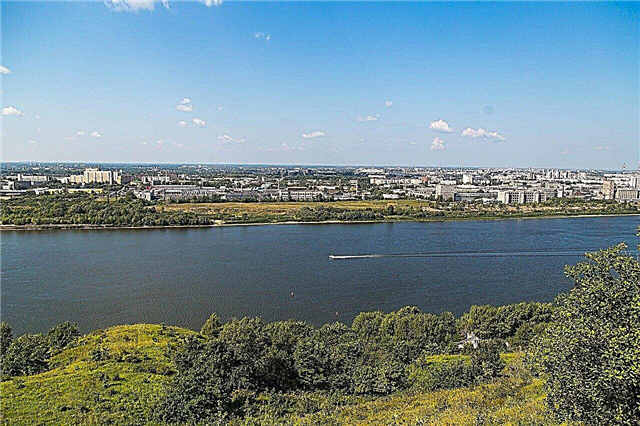
About a tenth of the largest European river is located in the Nizhny Novgorod region: from the Gorky reservoir to Vasilsursk. In the region on the Volga, another reservoir was formed: Cheboksary. River sections reach a width of 500 meters, and on reservoirs - several kilometers. The Volga divides the region into two climatic zones: the Right Bank (forest-steppe, higher part) and the forest Trans-Volga. On the river there are 10 large Nizhny Novgorod cities and towns and only one complex of bridges.
The length of the river is 3530 km, in the Nizhny Novgorod region - 277 km

Oka
The largest of the right tributaries of the Volga originates in the Oryol region. Through the territory of the Nizhny Novgorod region, the Oka makes its way to the place where it flows into the Volga (the famous arrow) in Nizhny Novgorod. The channel is rather winding, which impedes passenger traffic. The Oka is a flat river, it feeds on precipitation and melting snow. The bottom is clayey, which is why the water is slightly cloudy. There are 4 bridges across the river in the capital of the region, and 3 more in the region.
The length of the river is 1,500 km, in the Nizhny Novgorod region - 270 km

Vetluga
One of the largest tributaries of the Volga. The river passes through the Nizhny Novgorod land for more than three hundred kilometers, flowing into the Volga not far from Kozmodemyansk. At the confluence there is the Cheboksary reservoir. It flows through the taiga Trans-Volga region, the floodplain is swampy in places, there are many shoals and rifts on the river. Due to the frequent change of the channel, oxbows and lakes are formed. The depth is shallow, about 1.5 - 2 meters, width is from 50 meters in the upper reaches, to 150 - 200 meters - in the lower reaches.
The length of the river is 889 km, in the Nizhny Novgorod region - 323 km

Surah
The second largest tributary of the Volga after the Oka. It flows through the territory of 6 regions. The channel is winding, with sharp turns. The place where it flows into the Volga is the Cheboksary reservoir. In the lower reaches, the river is navigable, the current is calm, but quite fast. Due to the variety of fish and picturesque shores, it is attractive for river tourism.
The length of the river is 841 km, in the Nizhny Novgorod region - 164 km

Drunk
The entire length of the river is almost entirely in the Nizhny Novgorod region (partly in Mordovia). The riverbed is very winding, making a big loop, Piana flows into the Sura 65 km from its source. The hill inside this loop is called Mezhpianye. The river is very beautiful: high hilly banks, floodplain lakes, clear water with a lot of fish. The average width is 10 - 25 meters, at the mouth - up to 90 meters.
The total length of the river is 436 km

Tesha
Right tributary of the Oka. The source is located on the Volga Upland. There are many karst formations, mineral springs, karst lakes and curative mud. Fishing, rafting and boating are well developed on Tesha. The banks are high, the current is fast, the width is from 10-15 meters to 50 meters in the lower reaches. The river is densely populated along its entire length: the cities of Arzamas and Lukoyanov, many settlements and villages.
River length - 311 km

Tansy
It originates in the Nizhny Novgorod swamps, then flows into the Kirov region, where it flows into the Vyatka. In the Nizhny Novgorod region, Tansy flows through the forests of the southern taiga. There is a popular rafting route along the river, the channel is very winding, the current is weak. The water is quite transparent, has a brown peat shade. Both lovers of traditional fishing and spearfishing come here.
The length of the river is 305 km, in the Nizhny Novgorod region - 175 km

Kerzhenets
The left tributary of the Volga got its name from the Mordovian "kerzh", which means "left". It originates in the north of the region, flows into the Volga next to the Makaryevsky monastery (settlement Makaryevo). Part of the channel runs through the territory of the Kerzhensky Reserve. The river is ideal for boating and rafting: clear water, beaches, pine forests and oak groves. Lovers of historical tourism can visit the Old Believers' places.
River length - 290 km

Mouth
Almost the entire length of the river passes through the territory of the Nizhny Novgorod region, with the exception of a small section in Kirovskaya. It flows into Vetluga near the old village of Voskresenskoye. The channel is winding, along the banks there are many settlements. Water tourism is well developed, you can go kayaking. The shores are wooded, there are sandy beaches.
The total length of the river is 253 km

Seryozha
One of the largest tributaries of the Tesha. In the Arzamas region, it passes through the chain of the famous Pustynsk lakes. The basin is very swampy, so the banks are poorly populated, and the ecological situation is very favorable. There is good rafting and fishing on the river. Archaeological sites of the 1st - 2nd millennium AD were discovered in the upper reaches.
River length - 196 km

Urga
The left tributary of the Sura, in the lower course along the river passes the border of the Nizhny Novgorod region of Chuvashia. It flows mainly in open areas, on the way there are ravines and gullies. In the middle and lower reaches, the banks are steep and steep. The current is weak, the depth does not exceed 4 meters. The bottom is mostly sandy, the water is clear.
The total length of the river is 184 km

Uzola
A small river that runs through two districts of the Nizhny Novgorod region: Koverninsky and Gorodetsky. Khokhloma and Gorodets painting originated on its banks. It flows into the Volga opposite the town of Balakhna. The average depth is shallow, about 2 m; shoals and rifts are often found. The riverbed is winding and runs along meadow plains with pine forests. On the river there is a children's camp with a museum of aviation technology.
River length - 147 km

Kudma
Right tributary of the Volga. Kudma acts as the border of the forest in the resort village of Zeleny Gorod near Nizhny Novgorod. Several sanatoriums and rest houses have been built on its banks. The so-called Three Rivers is widely known - the territory between Kudma, Shava and Volga. Traditionally people come to these places for fishing and outdoor recreation.
River length - 144 km

Big Kaksha
It originates in the Kirov region, only 66 km of the total length passes through the territory of the Nizhny Novgorod region. It flows into the Vetluga along the left bank above the city of Vetluga. Passes through a wooded area, in places along the banks there are sandy areas, along the entire length there are numerous oxbows. Suitable for light alloys. The flora and fauna of the river and its floodplain are very diverse.
The total length of the river is 138 km

Linda
The left tributary of the Volga is relatively small. The river is quiet enough, flows in steep banks, there are golden sandy beaches. Tourists often float here, especially the route is suitable for beginners. Annually on Linda in the Semenovsky district (Uspenie village) the opening of the tourist season is held, which lasts from May to September.
River length - 122 km

Lunda
Lunda flows about 82 kilometers along the Nizhny Novgorod land. Lunda flows through remote forest places, with many swamps and lakes. There are not many settlements on the river, one of them is the village of Vladimirskoe.This is a famous pilgrimage site to Lake Svetloyar, with which the river is connected by a small stream. By the types of fish and the specifics of fishing, the river is often compared to Kerzhenets. The riverbed is winding, the depth is 1-2 meters, the width does not exceed 30 meters.
The total length of the river is 121 km

Vaya
The right tributary of the Usta, runs along the border of the Shakhunsky district, in the north of the Nizhny Novgorod region. Throughout its length, the channel winds strongly among the wooded area. The current is fast, the banks are high, but there are flooded areas. Lovers of rafting, fishing and hunting for water birds come to the river.
River length - 106 km

Veletma
A small tributary of the Oka. It starts near the city of Vyksa, passes through several villages and settlements. The Veletema reservoir is located on the river (in the village of Veletma). The lower course of the river is located on the Priokskaya lowland, here on the Velet'ma there is the city of Navashino. The confluence with the Oka is 10 km from Murom.
River length - 99 km

Sundovik
A small right tributary of the Volga. Width from 15 meters in the middle reaches to 40 meters at the mouth. The depth is shallow, from 1-2 meters, in some places it reaches 4 meters. The current is fast, the bottom is mostly sandy, with pebble areas, in places large stones form rifts. A reservoir has been built on the river in the village of Bolshoye Murashkino. There is good fishing on the river, there is a rare species of pure white crucian carp.
River length - 99 km

Ox (Midday Ox)
The right tributary of the Vetluga. It is completely located on the territory of the Vetluzhsky district, in the north of the Nizhny Novgorod region. On its way it takes about 10 small tributaries. There are several villages and villages on the banks, the largest of them is the village named after Kalinin. The river is suitable for rafting, the banks are mostly covered with forest, the channel is winding, the width varies from 1 meter to 5-10 meters.
River length - 97 km

Dorogucha
One of the small tributaries of the Volga. 59 km long is located on the territory of the Vorotynsky district of the Nizhny Novgorod region. Here, near the village of Kuzmiyar, is the beginning of the river, which is formed by the confluence of the Upper Doroguchi and the Lower. It flows into the Volga along the left bank in the Republic of Mari-El. The river is suitable for rafting in spring, shallow in summer. The water is clear, but with a brownish-red tint. There are many interesting lakes in the valley, the places are deserted.
The total length of the river is 94 km

Eames
The largest tributary of the Urga flows into it along the left bank below the village of Krasnaya Gorka. In this place, the river bank is very high, with beautiful views, which gave the name to the village. The source is located just above the town of Knyaginino. In some areas, due to the ongoing reclamation work, the channel has turned into a small canal. In the lower reaches, the width is about 25 meters, the river forms islands and creeks.
River length - 91 km

Malaya Kaksha
The river flows through the territory of three districts of the Nizhny Novgorod region. It originates near Tonshaevo and flows into the Vetluga along the left bank above the city of Vetluga. It is divided into three sleeves before the confluence. The upper reaches are densely populated. Further, the river passes through the dense forests of the southern taiga. The banks are steep, the channel narrows and winds in places, but in general the river is an interesting route for rafting.
River length - 91 km

Yurong
The left tributary of the Vetluga, the main part of which (69 km) is located in the Nizhny Novgorod region. The mouth of the river is located in the Mari Republic. The source is near the village of Sharanga, on the territory of the Kilemarsky forest reserve (an array of southern taiga with oak forests is protected here). There is a very beautiful Yurong Lake in the river bed. All the way, many clean streams and rivulets flow into the river; there are many cranberry bogs in the vicinity.
The total length of the river is 88 km

Lapshanga
The right tributary of the Vetluga starts at the border with the Kostroma region. It passes through the territory of two districts of the Nizhny Novgorod region, the mouth is located near the village of Varnavino. The banks are steep, gently sloping areas are mostly flooded. There is a belief among local residents that there were ancient monasteries and holy places in this area.
River length - 85 km

Medyana
The beginning of the river is considered to be the confluence of Malaya and Bolshaya Medyana. From this point to the mouth, the length of the river is 59 km. It flows into the Sura along the right bank. It flows through the northern part of the Volga Upland. The area is densely populated, covered with dense forests, in places cut by ravines and gullies. The river basin contains 38 natural lakes and ponds. The average width is about 30 meters, the current is slow, there is a lot of reeds and other river vegetation along the banks.
River length - 83 km

Ozerka
It flows in the Dalnekonstantinovsky district, south of Nizhny Novgorod. The width is on average 5-7 meters (there are strong narrowings up to 1 - 2 meters). However, the river in the area is the largest. There are several villages and settlements on it, where you can visit: the Somovy Gory Memorial (a complex of monuments), an old manor in Simbiley, a 19th century church in Pomry, a wooden church of the 18th century in Rumyantsevo.
River length - 74 km

Kishma
The second name of the river is Vorsma. It originates near the village of Babkino at the walls of an old abandoned bell tower. It flows through the territory of three districts of the region and flows into the Oka along the right bank near the village of Okulovo, Pavlovsky district. The treeless area along which the river flows is heavily karsted. There are many bends along the entire length, in some sections the river changes its course. Kishma passes through the large karst lake Vorsmenskoye, which is why it got another name.
River length - 71 km

Check
A small river originates in the Volga Upland and flows along a treeless plain bordered by hills and islets of coniferous and deciduous forests. Despite its short length, it receives more than 90 tributaries on its way, there are 75 lakes and ponds in the basin. The depth is about 1.5 m, the banks are high, overgrown with willow and sedge, there are many snags at the bottom.
River length - 70 km

Hedgehog
The largest tributary of the Piana flows into it along the left bank above the village of Gagino. It originates in the Volga Upland, not far from the source of the Tyosha. These places are included in the list of protected natural monuments. It flows on a treeless plain, the valley is densely populated. The depth is shallow, the bottom is silted. The channel winds strongly, in places it is divided into sleeves, there are many oxbows.
River length - 64 km


